
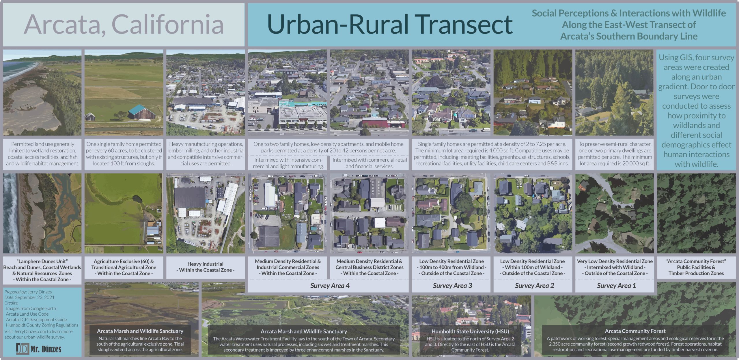
This page provides urban-wildland transect design tips, with a focus on using GIS for residential survey development. The transect should not be confused with the wildland-urban interface (“WUI”), the area where residential development is located proximate to wildland vegetation. Due to a national focus of fire management, WUI studies most often focus on identifying fire hazard threats.
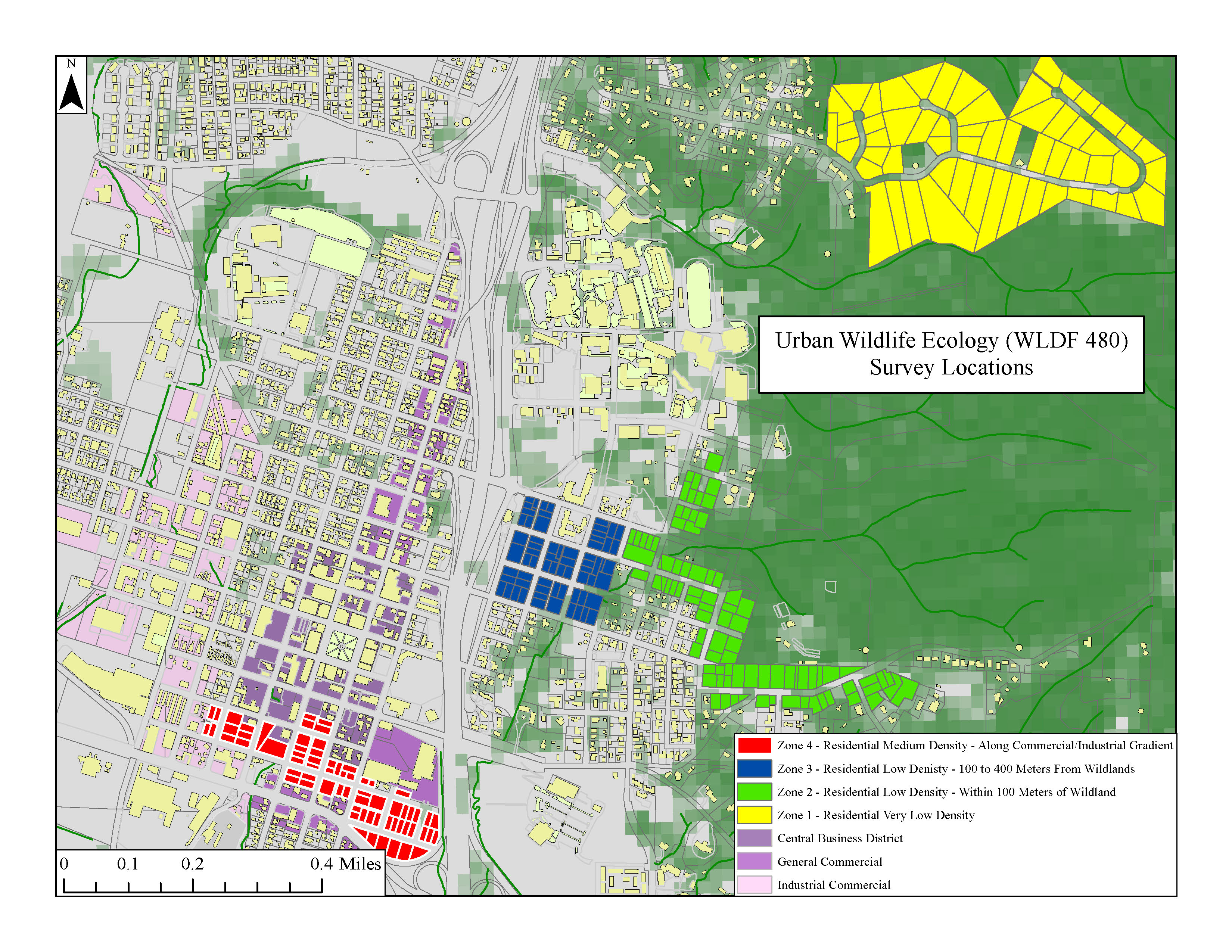
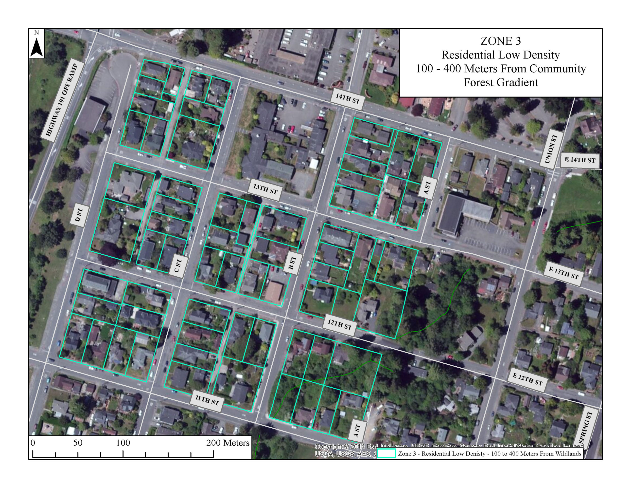
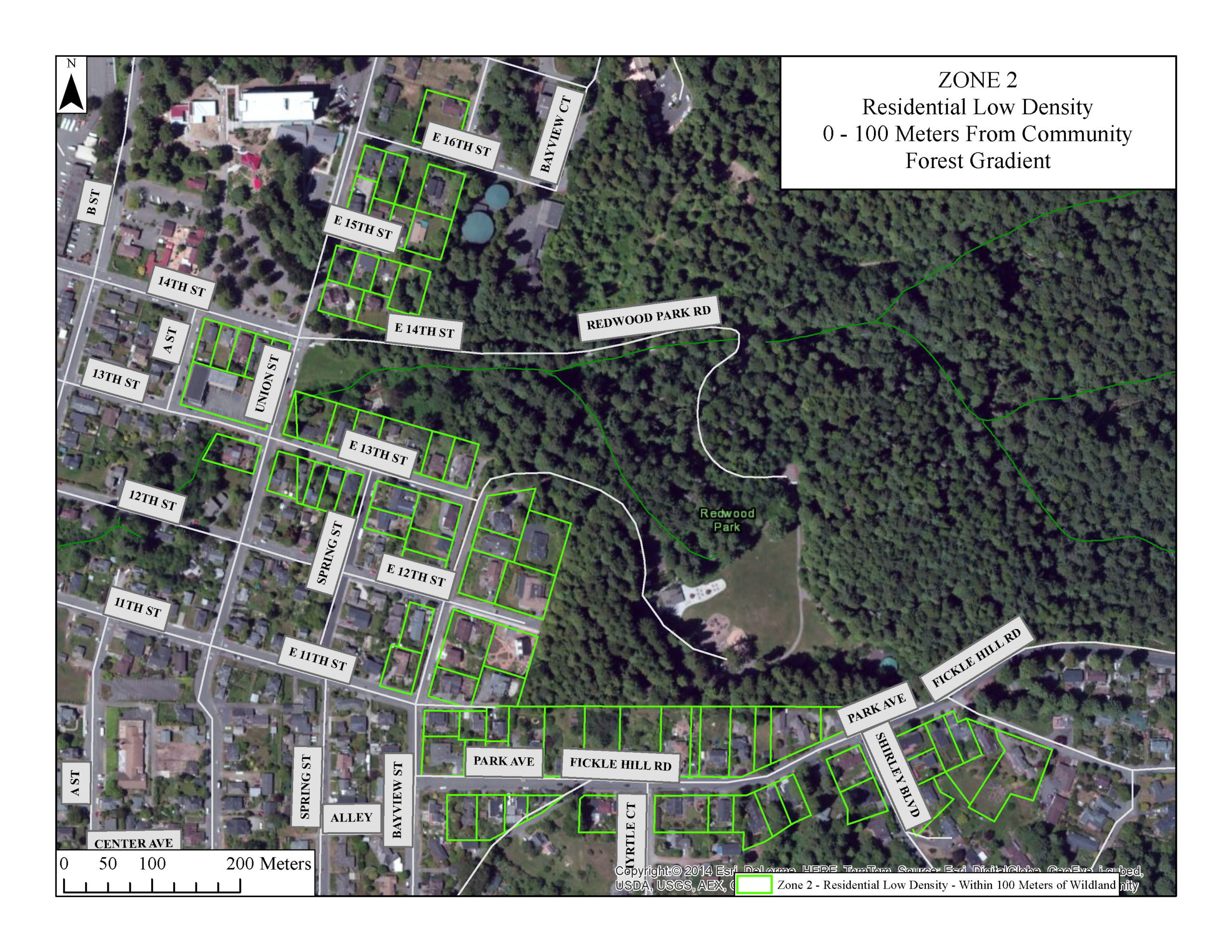
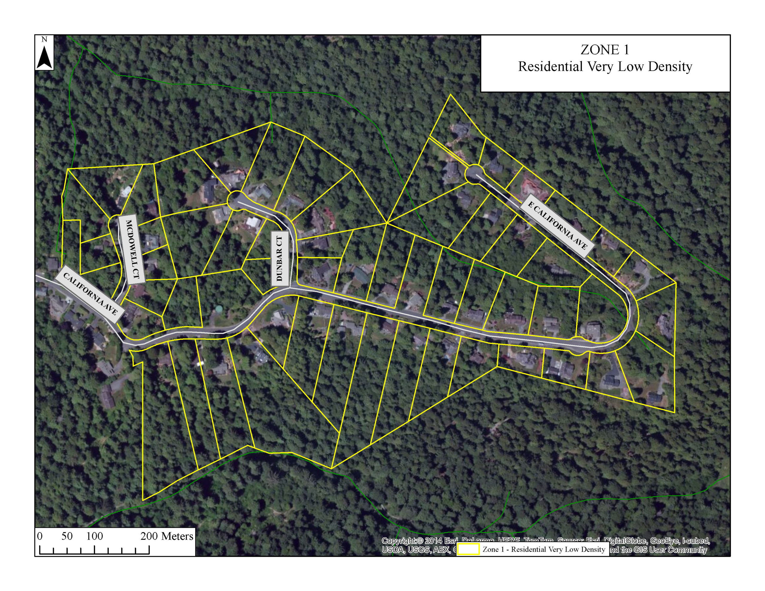
An urban-wildland transect necessarily includes the WUI, but it represents a gradient that may extend beyond, either in the urban or wildland direction. In our study, the transect is more heavily weighted to to the urban side of the gradient. The urban gradient represents different housing densities and land use intensities. (It would be appropriate to call the our transect an urban-rural transect, but I think of this concept as a tool for setting design standards).
While our study looks at human behavior relative to distance from wildland, you may be studying animal behavior relative to distance from urban development. In such a case, your transect may be weighted to the wildland side.
1 – Parcel-Level Data
At a minimum, a residential survey should include a parcel-level geodatabase with a street address attribute field. This is necessary for site selection in the door to door survey and it ensures that the survey teams will adhere to their areas. However, you should consider joining other parcel level data to this geodatabase, such as property value assessments, which may add new dimensions to your analysis.
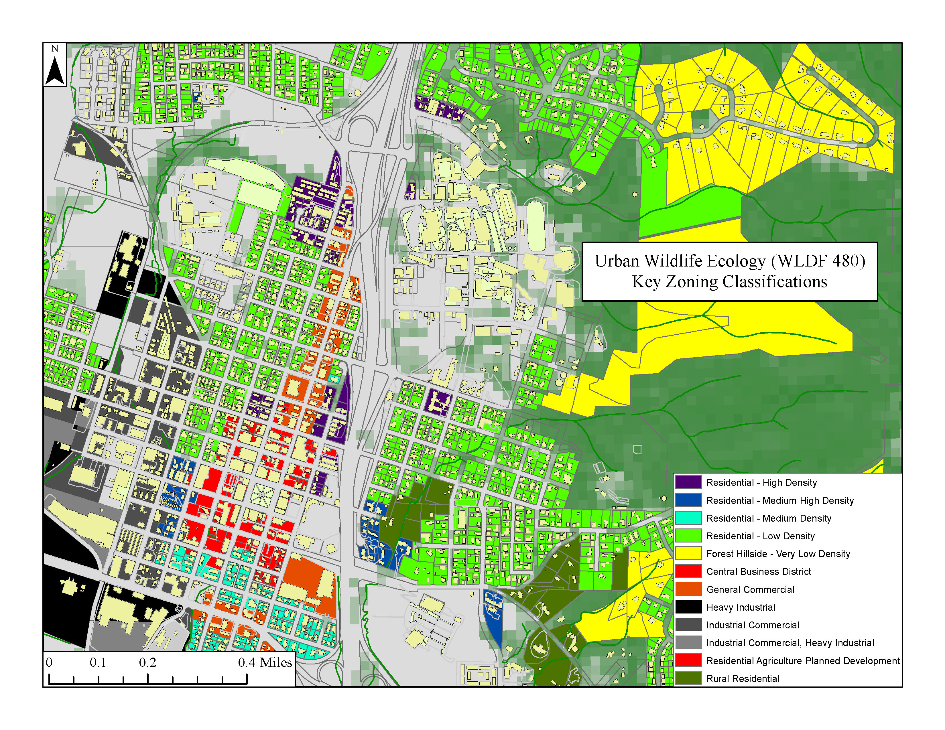
2 – Zoning Data
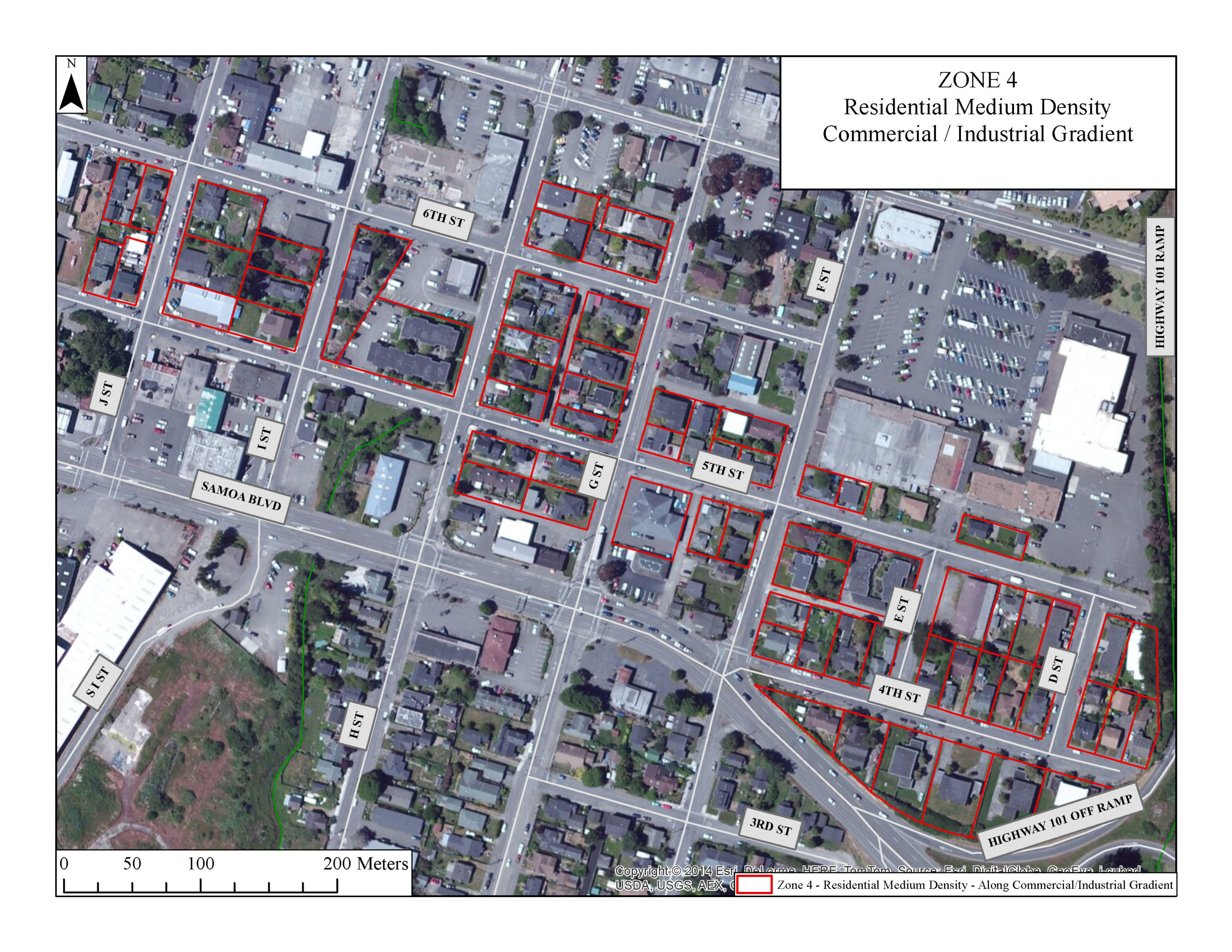
A zoning shapefile is necessary to create an urban transect that is tiered by land use intensity (e.g., low to high density residential; commercial and industrial land use).1 Note that zoning classifications might be built into parcel layer that you acquire. From the same local government body that provides the GIS-based zoning data, you must also acquire the land use codes that explain the restrictions and allowances associated with each zone.
3 – Tree Canopy Cover (Optional)
Tree canopy cover (TCC) raster data is obtained through the U.S. Forest Service, and may be used in defining one or more “wildland” tiers along the transect (see next step). However, the value of TCC data will be limited where canopy cover is not a distinguishable feature of the wildland (e.g., certain desert biomes). Additionally, TCC data may be used as a basis for parcel-level site selection. Consider that a neighborhood (or individual parcel) with greater canopy coverage may be a wildlife attractant.
4 -Wildland Shapefile and Necessary Attribute Data
Finally, shapefiles representing “wildland,” or tiers of wildland, must be created in order to define the natural end of the transect. The data necessary to creating wildland tiers will depend on the study purpose. Thus, the first step here is to concisely define “wildland” within the purpose of your study, Next, determine what mappable attributes are necessary to satisfy that definition.
In our study, the wildland is simply the heavily forested areas (generally, the TCC was approx. 100%). We joined parcel files representing the Arcata Community Forest to create our wildland shapefile.
Maps by Jerry Dinzes
© 2019 – The Official Website for Jerry Dinzes.