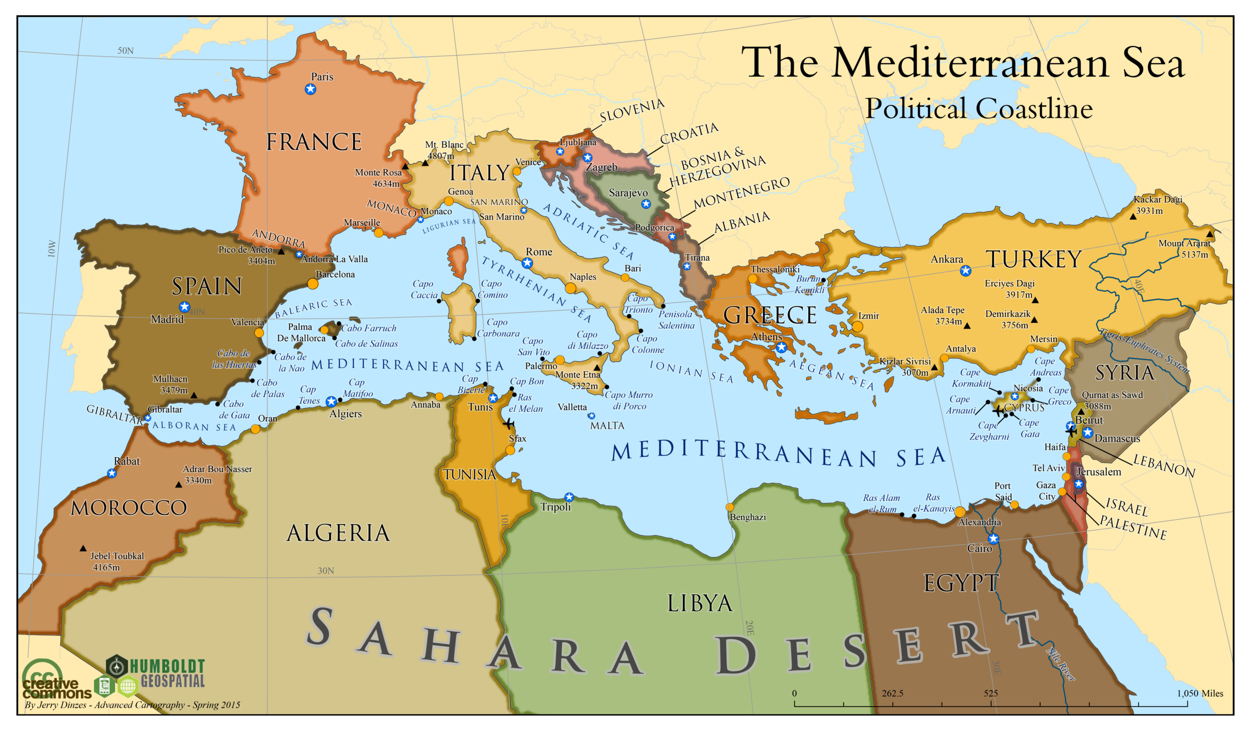
This is one the first maps that I designed in Adobe Illustrator. Looking back on this map, I see the lack of labeled features in Africa as cartographic injustice. While I used population size as the threshold for determining which cities were labeled, I should have changed the parameters for identifying population hubs in North Africa.
The lack of ethnic and cartographic balance aside, I discovered my love of vector layers while designing this basic social studies map. I was already aware of my love of pastels, which social studies maps lend themselves to.
Advanced Cartographic Design Seminar (2015)
Maps by Jerry Dinzes
More Maps by Jerry Dinzes
Urban-Wildland Transect Design
Design Tutorial
This page provides tips for designing a wildland-urban transect using GIS, primarily for the purpose...
Race and Property Law in Los Angeles from 1892 to 1948
Legal Research
This project involved research into the development of caselaw on racially restrictive covenants (RRCs) in Los...
Mapping De Facto Segregation
Historic Landuse Analysis
Prior to taking on the official research assistant position, I volunteered to produce maps in...
The Front Range at Golden, Colorado
Relief Map
This topographic map was designed for the purpose of showing off the mesas and hogbacks...
Von Damien’s Land (RPG)
Design Tutorial
Fantasy map and role playing game (RPG) based on the skull of Alexander Pearce. Includes...
Classroom to the Capitol
Lobby Leave-Behind
I served in multiple executive officer positions with the Associated Students of HSU (AS), and...
Controversial Whaling Map for Gamers
Advocacy Map
As is so often the case, two competing views can both be valid. By example,...
Animated Water Use by California County
First-Last Animated Map
Initially, I prepared a large amount of data (for GIS) and vector based illustrations with the...
Precipitation in California: 1950 to 2014
Visualizing Climate
This time series required the acquisition of 61 years of precipitation data for every gauge...
Community-Based Fire Prevention
Hazard Planning
In 2015, the Humboldt County Fire Safe Council requested assistance from the Humboldt State University Environmental...
Student Origins Illustrated
Diversity Map
Humboldt State University (HSU) is the most geographically isolated campus in the California State University...
Urban Wildlife Interactions in Arcata, California
Survey & Scientific Report
The area where residential development is located proximate to wildland vegetation is known as the...
Impervious Surface at Lake Tahoe
Relief Map
I mapped impervious surfaces in alarming colors to call attention to one of the environmental...
Alternate Reality America Map
Fantasy Map
I was definitely trying to get into the steam punk genre when I produced this...
California State University Student Atlas
Advocacy Atlas
This atlas style poster has an edgy and disgruntled student thing going on, as it...
Urban-Wildland Transect Design
Design Tutorial
This page provides tips for designing a wildland-urban transect using...
Race and Property Law in Los Angeles from 1892 to 1948
Legal Research
This project involved research into the development of caselaw on...
Mapping De Facto Segregation
Historic Landuse Analysis
Prior to taking on the official research assistant position, I...
The Front Range at Golden, Colorado
Relief Map
This topographic map was designed for the purpose of showing...
Von Damien’s Land (RPG)
Design Tutorial
Fantasy map and role playing game (RPG) based on the...
Classroom to the Capitol
Lobby Leave-Behind
I served in multiple executive officer positions with the Associated...
Controversial Whaling Map for Gamers
Advocacy Map
As is so often the case, two competing views can...
Animated Water Use by California County
First-Last Animated Map
Initially, I prepared a large amount of data (for GIS)...
Precipitation in California: 1950 to 2014
Visualizing Climate
This time series required the acquisition of 61 years of...
Community-Based Fire Prevention
Hazard Planning
In 2015, the Humboldt County Fire Safe Council requested assistance from...
Student Origins Illustrated
Diversity Map
Humboldt State University (HSU) is the most geographically isolated campus...
Urban Wildlife Interactions in Arcata, California
Survey & Scientific Report
The area where residential development is located proximate to wildland...