Denver, Colorado
/
/
Redwood Creek Watershed Delineation

Redwood Creek Watershed Delineation

Scientific Report

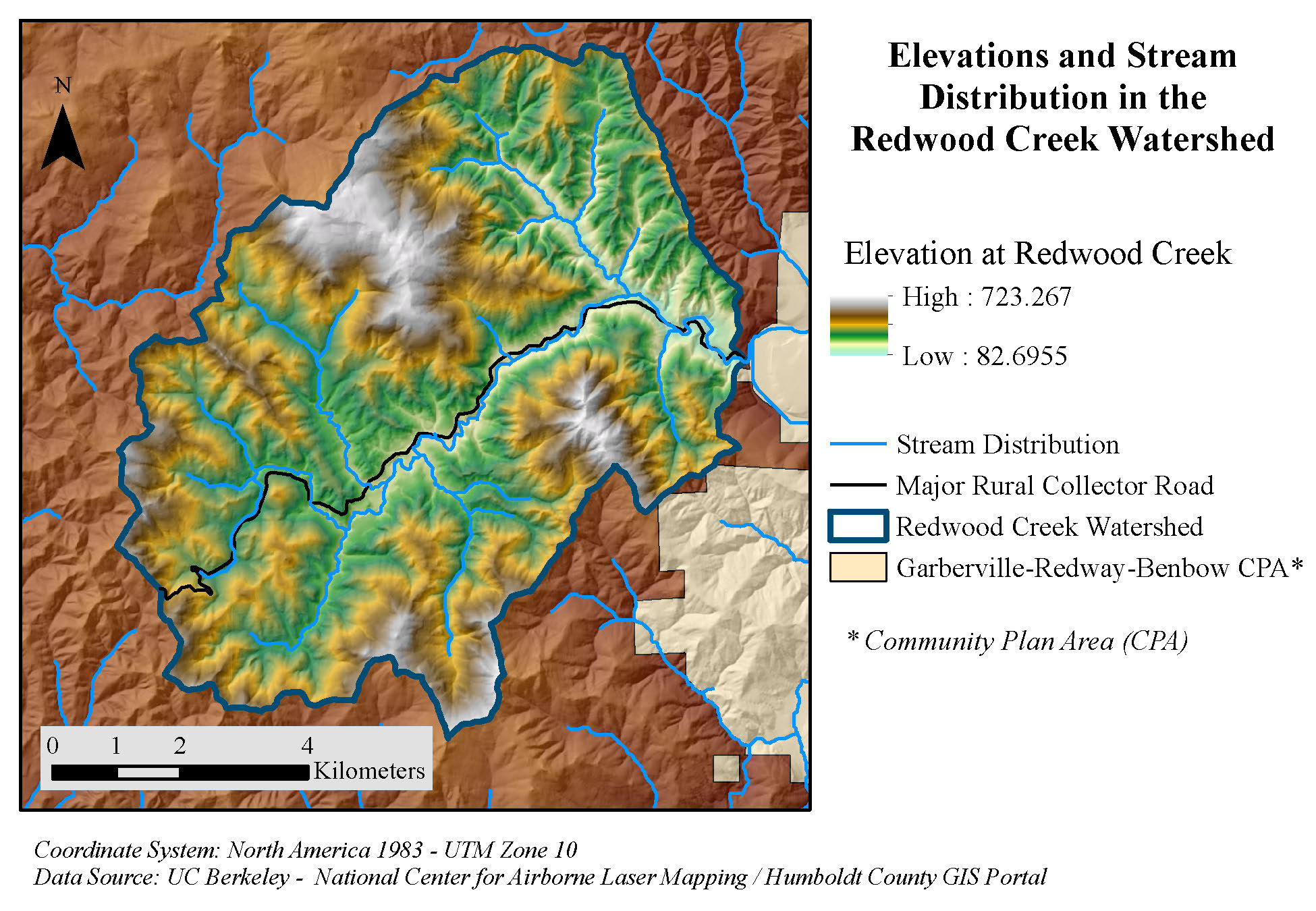
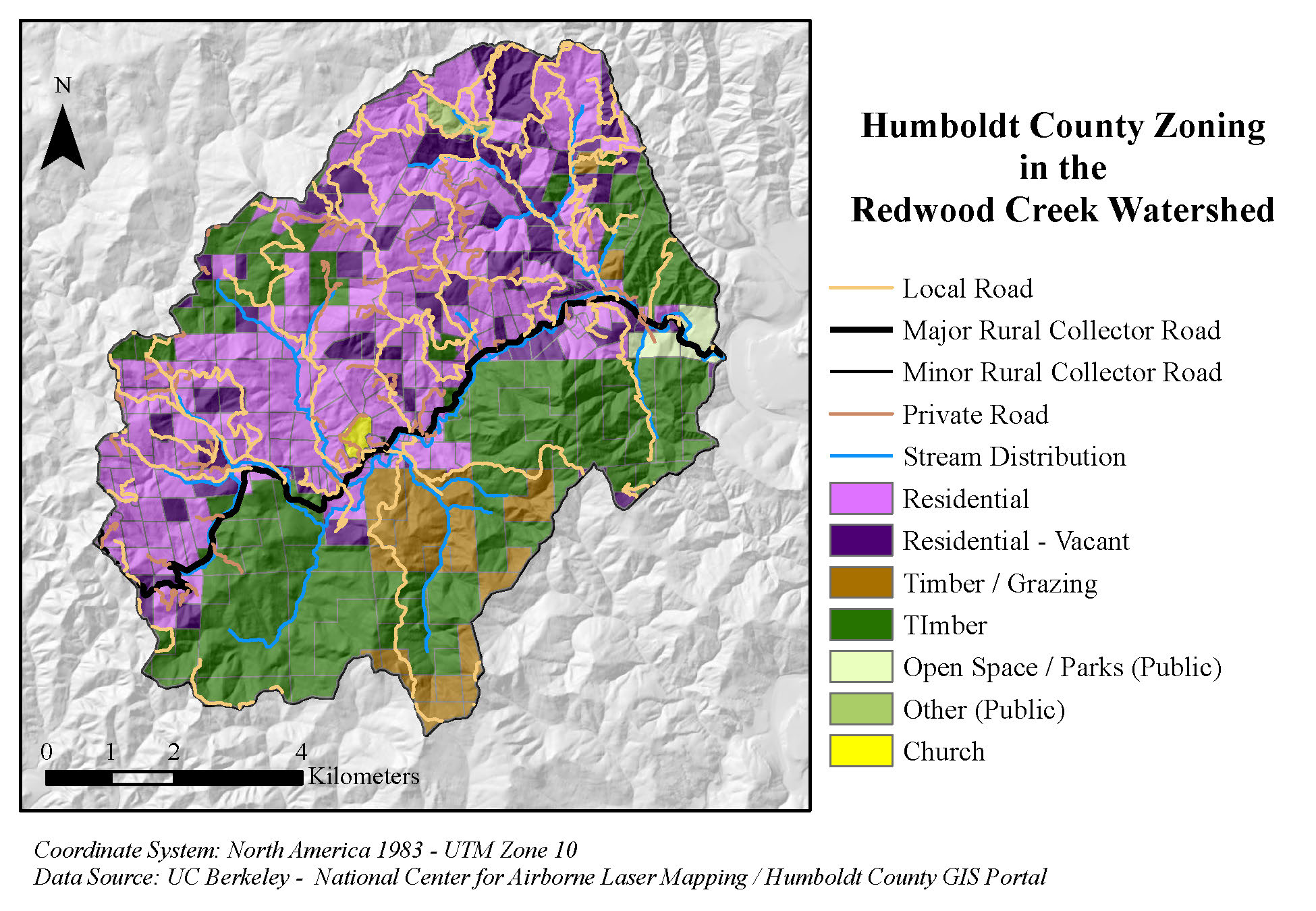
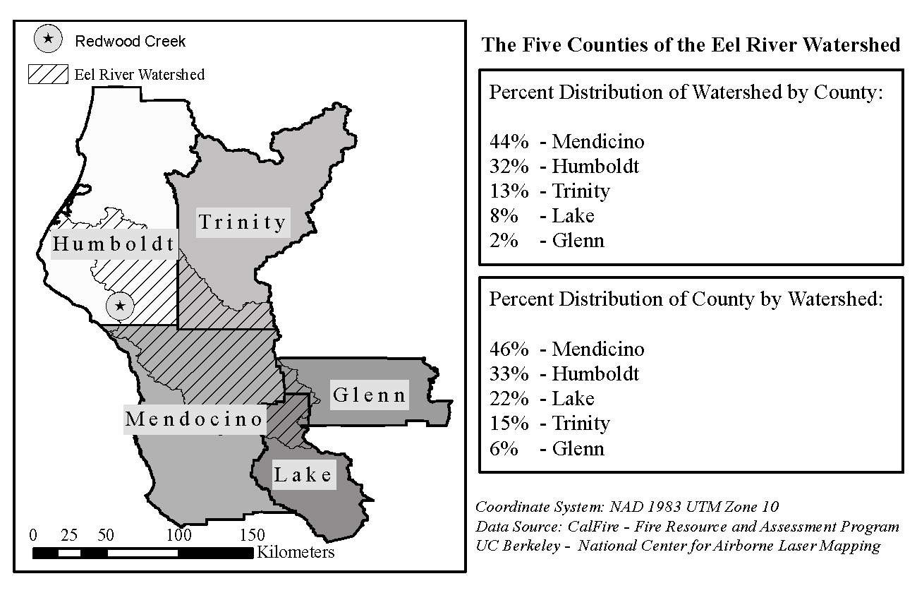
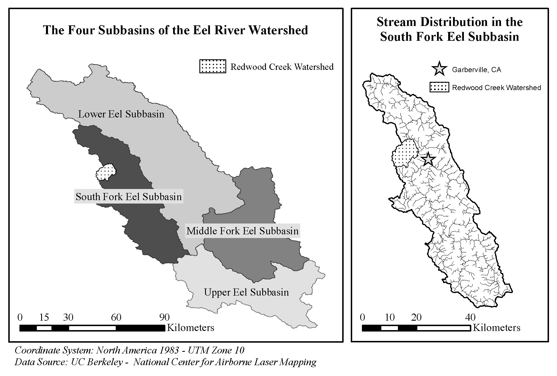
The political lines of local government are often drawn without consideration of watershed boundaries. As such, proper management of a watershed will frequently require a multigovernmental effort. 

I developed this map series to accompany and provide basic watershed data for good friend’s thesis project. 

Independent Project (2014) 

Maps by Jerry Dinzes

Related Maps

Animated Water Use by California County

Initially, I prepared a large amount of data (for GIS) and vector based illustrations with the…

Urban Wildlife Interactions in Arcata, California

The area where residential development is located proximate to wildland vegetation is known as the…

Impervious Surface at Lake Tahoe

I mapped impervious surfaces in alarming colors to call attention to one of the environmental…

Mad River Bridge Compensatory Wetland Study

In 2014, our team conducted a wetland delineation to gauge the success of a compensatory wetland project.…

More Maps by Jerry Dinzes

© 2019 – The Official Website for Jerry Dinzes.