Denver, Colorado
/
/
Impervious Surface at Lake Tahoe

Impervious Surface at Lake Tahoe

Relief Map

I spent nine years living on Lake Tahoe’s north shore. While I enjoy getting onto the mountains during a snowy Tahoe winter, it’s the summer time and that big blue lake that kept me there. But “keeping Tahoe blue” is not an easy feat. I witnessed first hand the rapid growth of algae along the shorelines that were completely free of it only a few years earlier. 
 
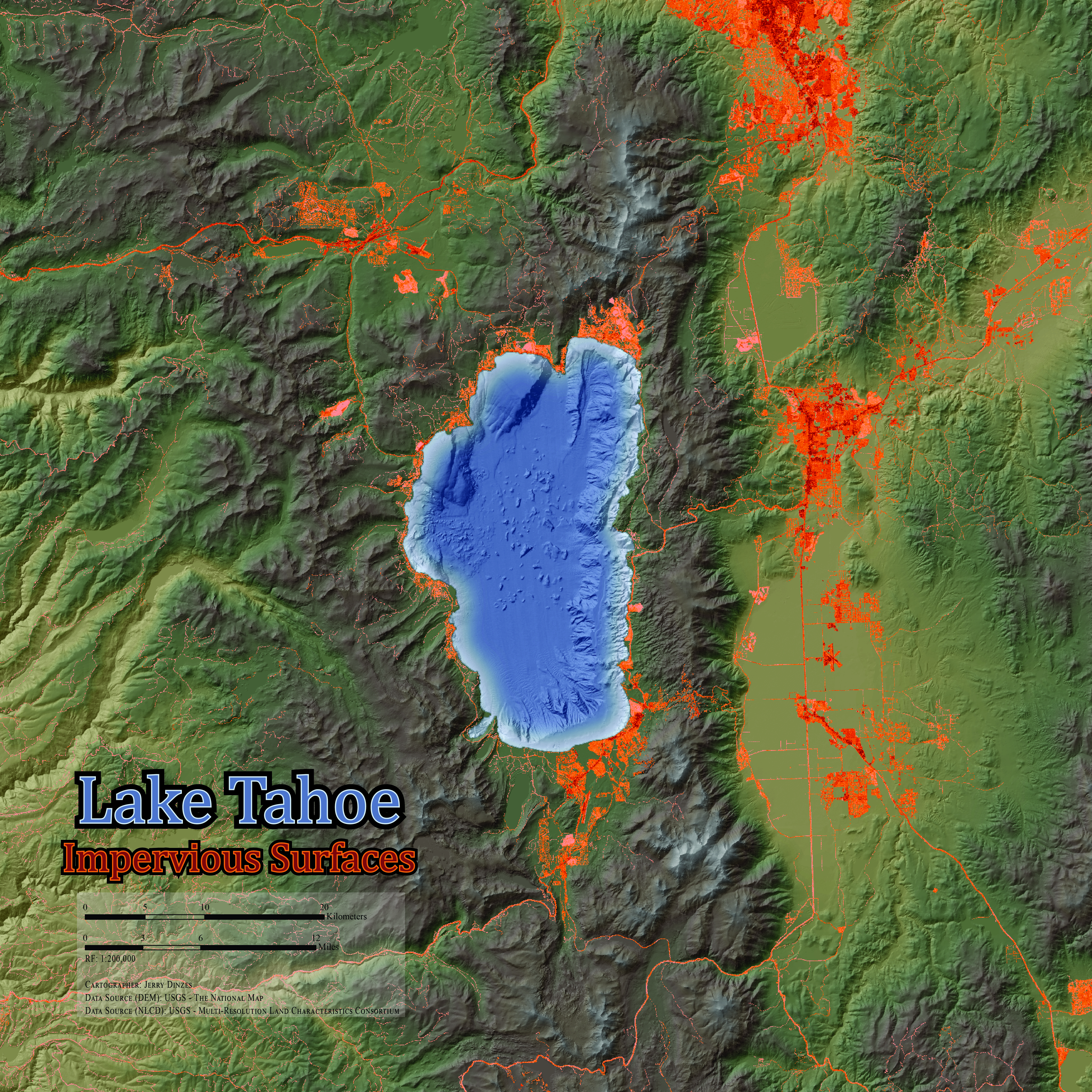
I mapped impervious surfaces in alarming colors to call attention to one of the environmental challenges that land planners face in trying to prevent the degradation of lake clarity and quality.  Impervious surface is related to urbanization, and it increases the rate and quantity of runoff into Lake Tahoe.
Tahoe Impervious Relief Map by Jerry Dinzes

Advance Cartographic Design Seminar (2015)

Maps by Jerry Dinzes

Related Maps

The Front Range at Golden, Colorado

This topographic map was designed for the purpose of showing off the mesas and hogbacks…

Community-Based Fire Prevention

In 2015, the Humboldt County Fire Safe Council requested assistance from the Humboldt State University Environmental…

Urban Wildlife Interactions in Arcata, California

The area where residential development is located proximate to wildland vegetation is known as the…

More Maps by Jerry Dinzes

© 2019 – The Official Website for Jerry Dinzes.