
In 2015, the Humboldt County Fire Safe Council requested project assistance from the Humboldt State University (HSU) Environmental Management and Protection Program. The project included two separate components, the development of Firewise mapping materials and support for community organizing efforts of the Upper Jacoby Creek Firewise Community. Upon completion of the project, our team submitted a report and presented before the Council.
Our project team members were Eileen Nunez, Chibu Okezie, Hether Ward, and myself, Jerry Dinzes. Throughout the project we were advised by Dr. Yvonne Everett, Professor of Environmental and Natural Resource Planning.
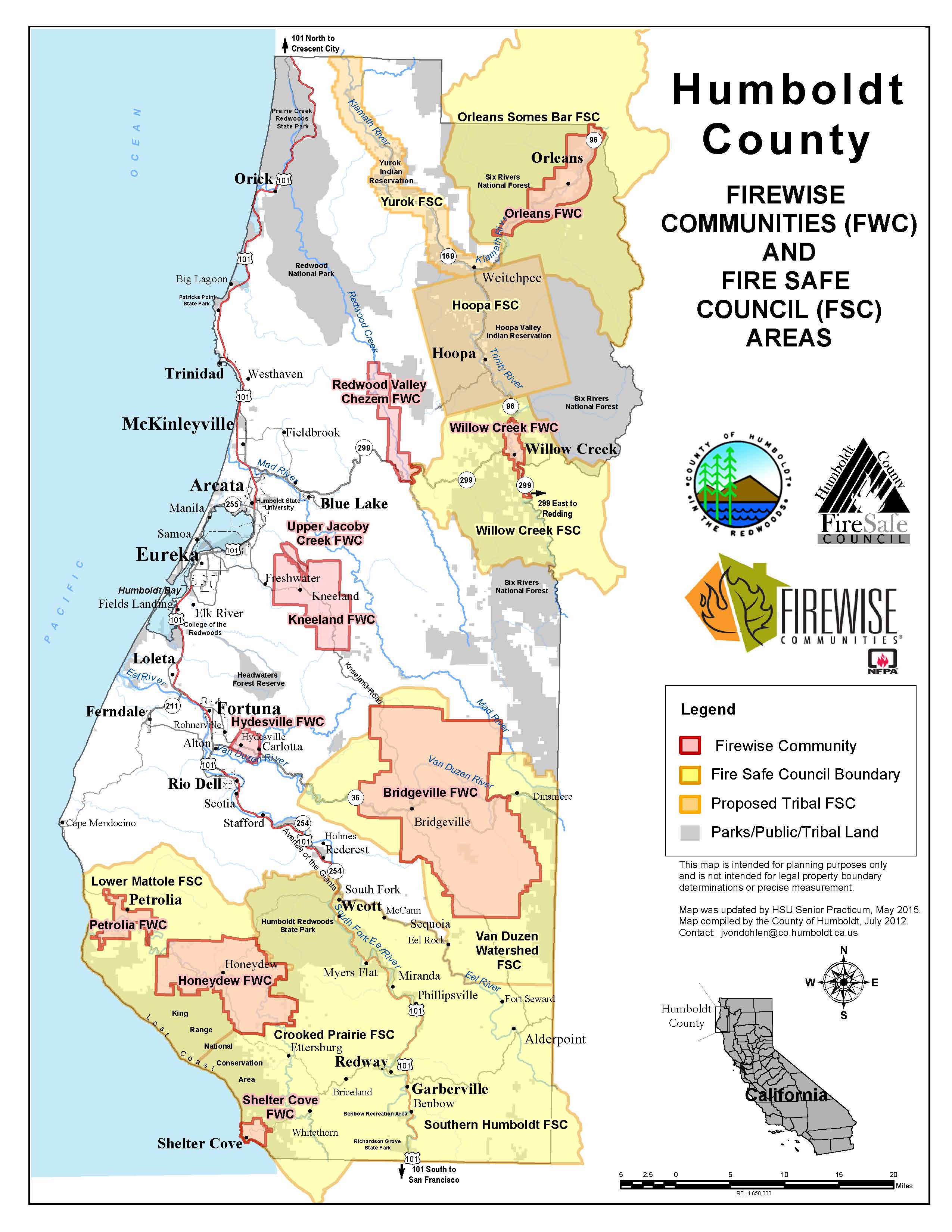
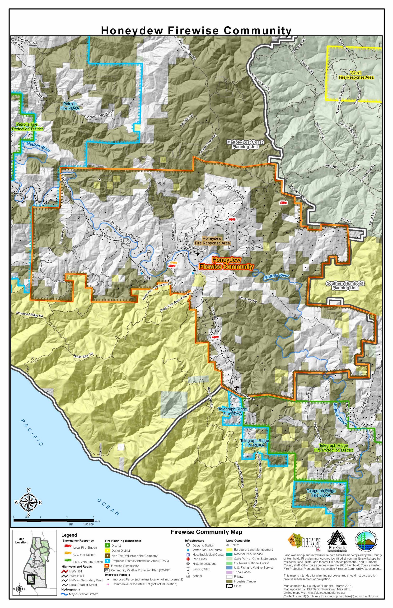
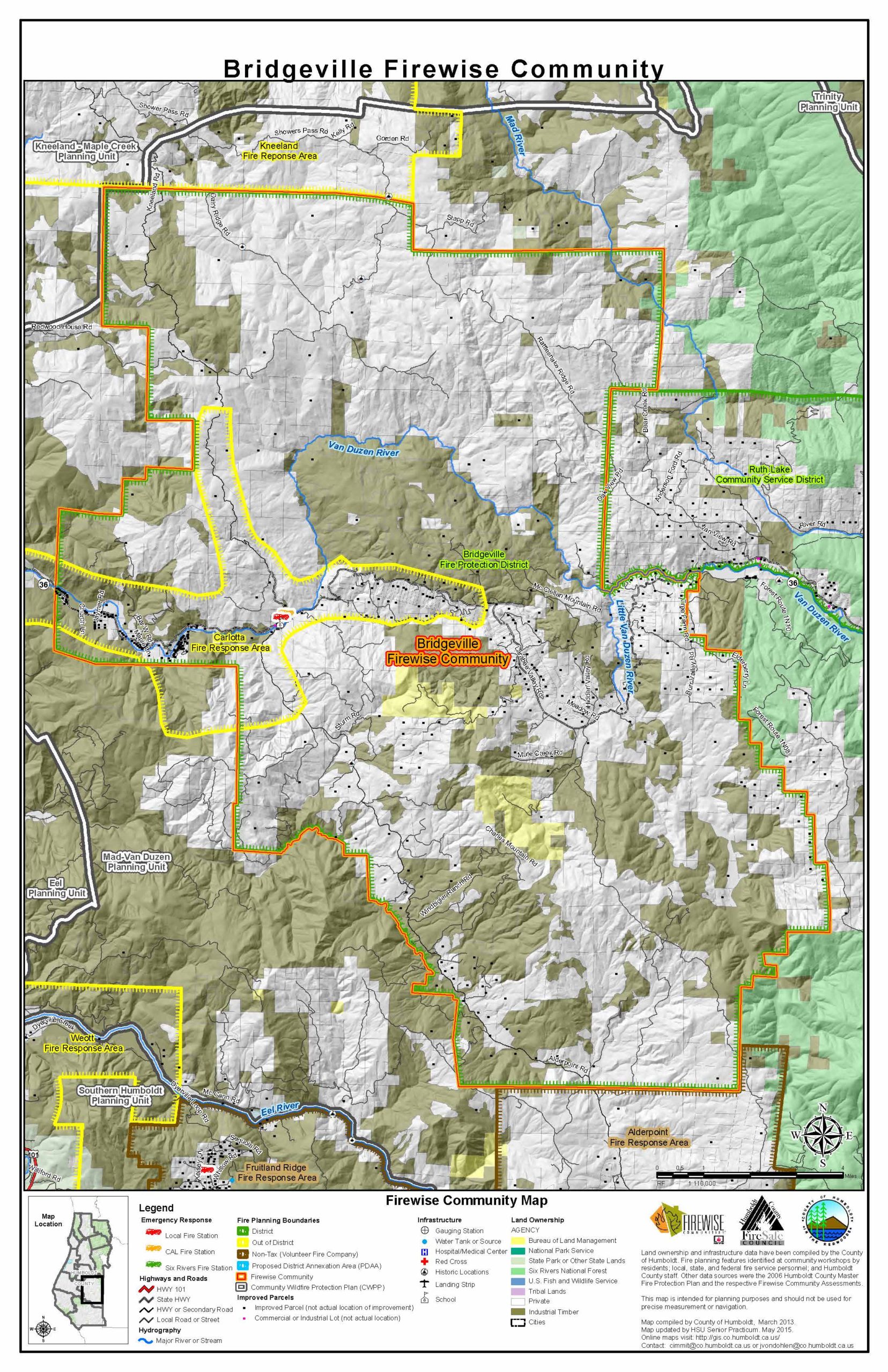
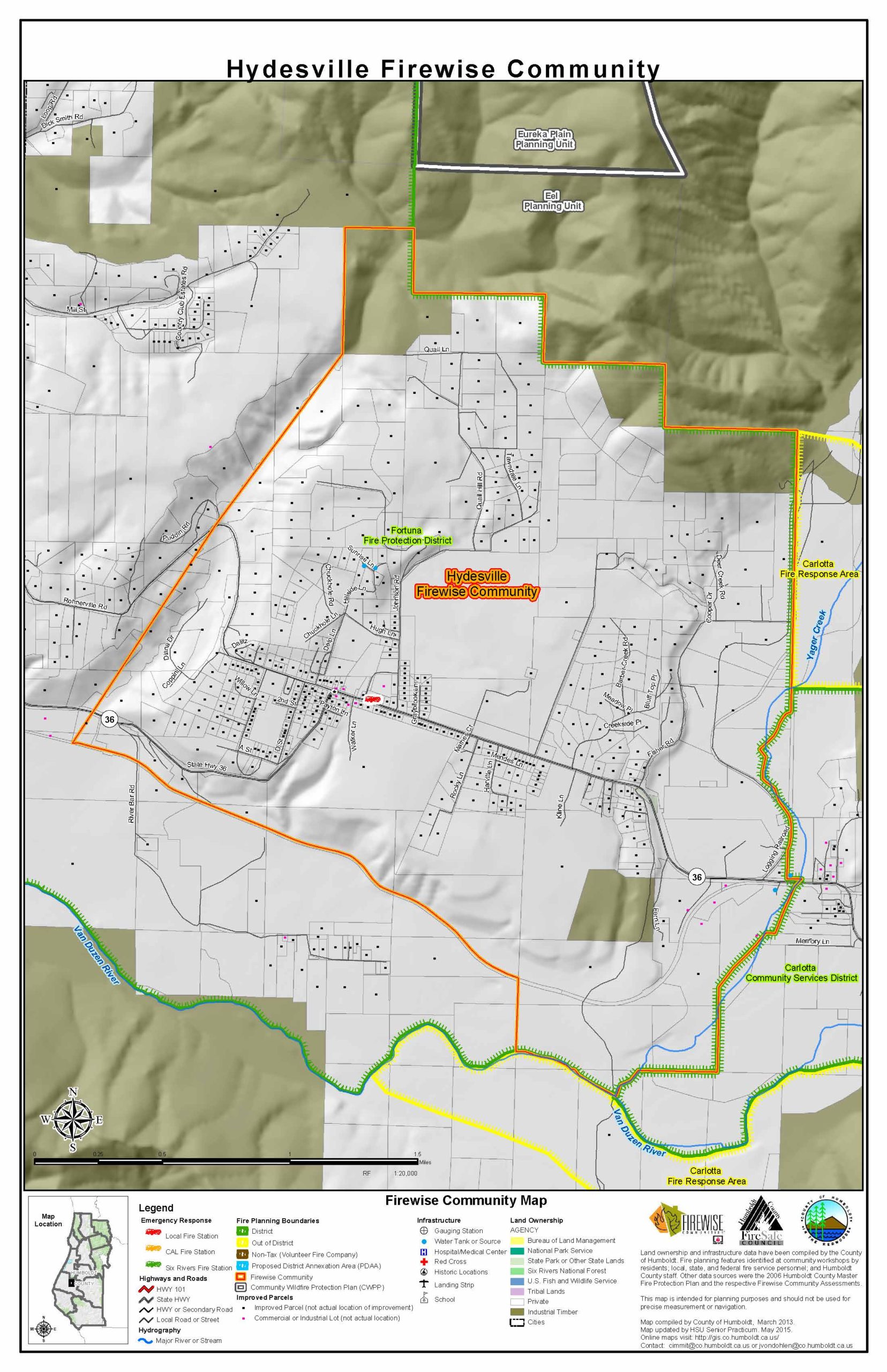
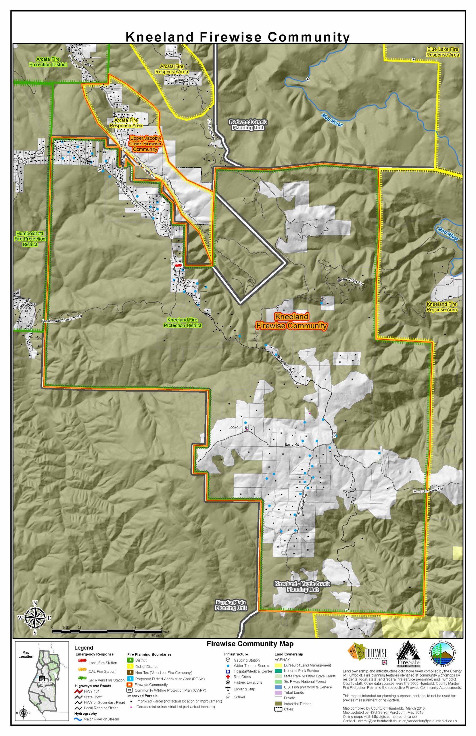
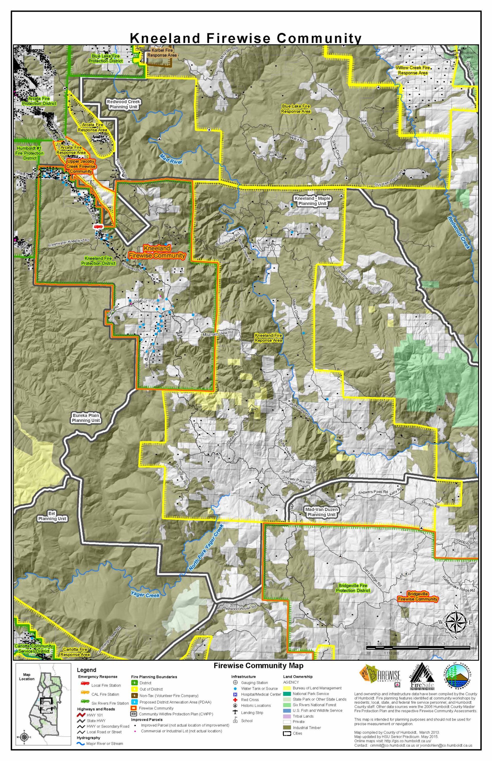
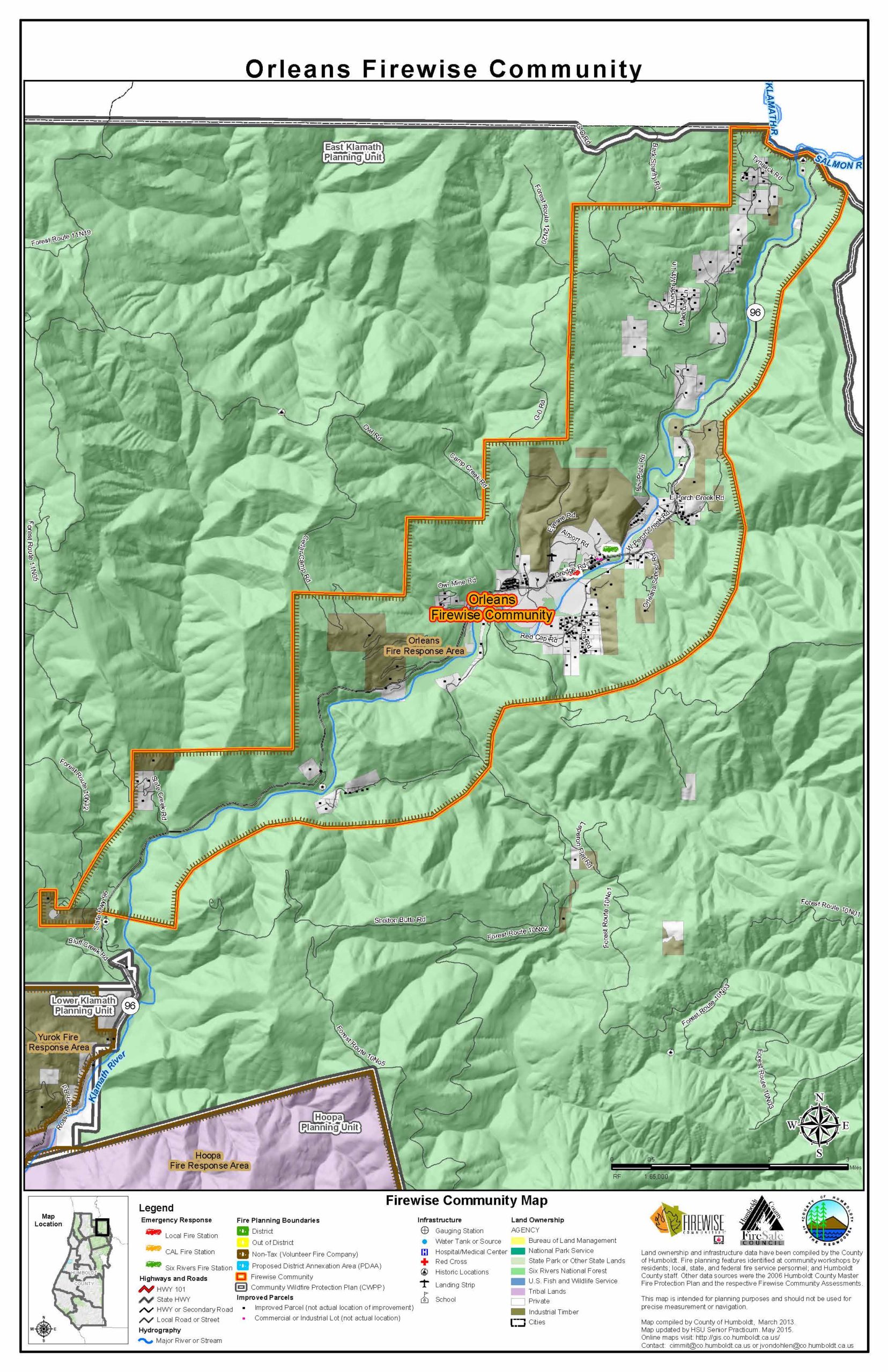
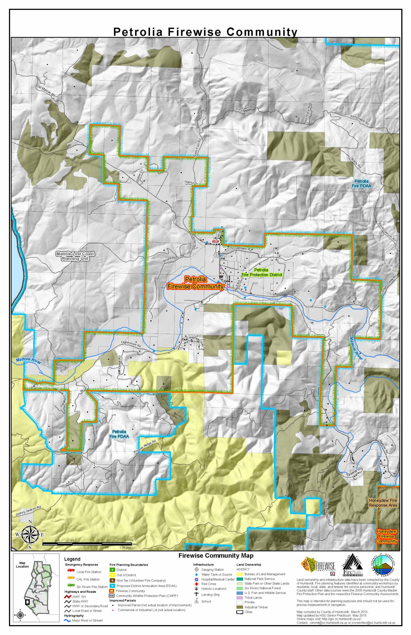
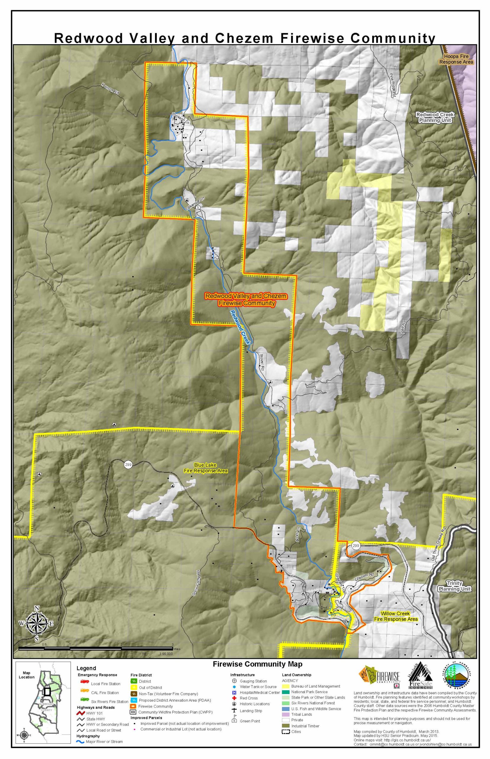
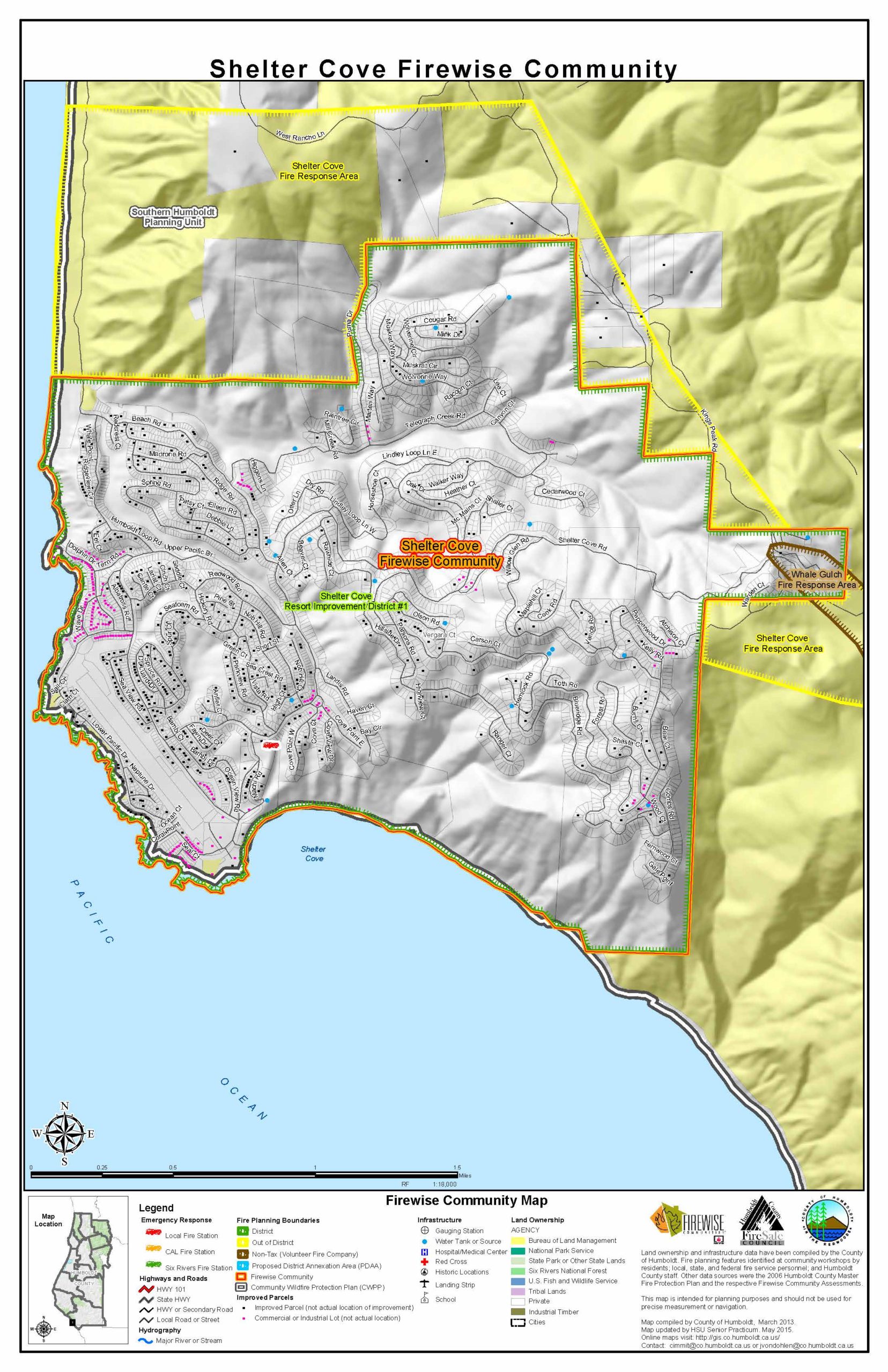
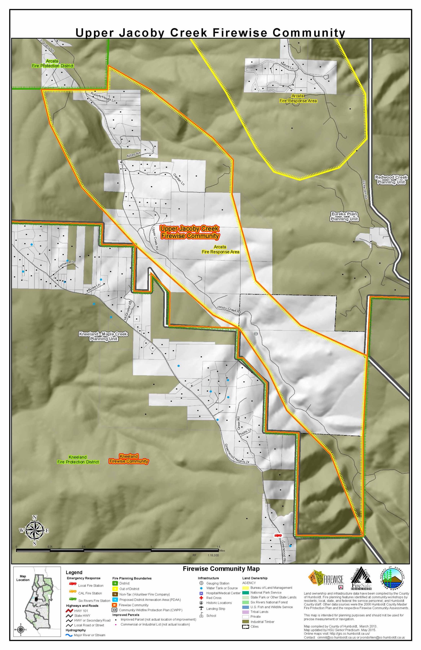
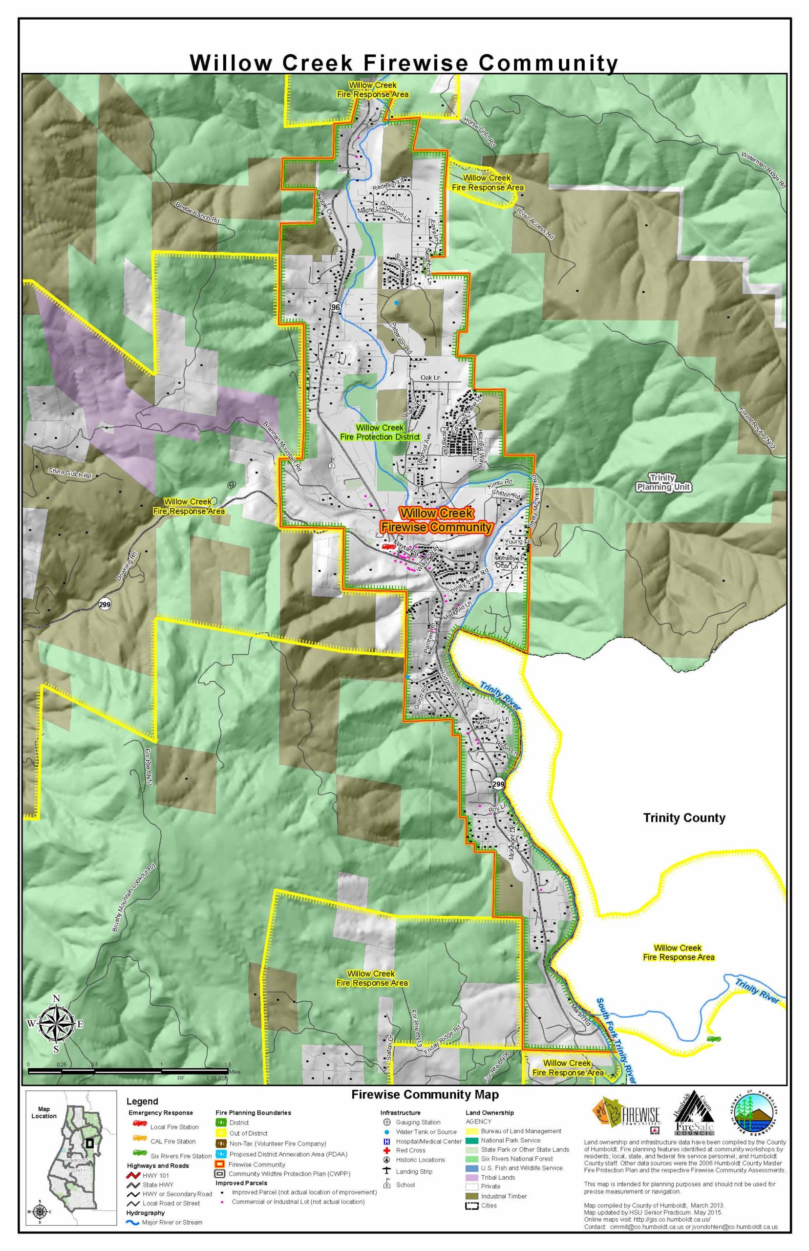
I served our team as the geographic information system (GIS) specialist, developing a county wide GIS layer of then-existing ten Firewise communities and creating individual maps for each community. We met periodically with the Geographic Information Systems Coordinator of Humboldt County, Jerry von Dohlen, receiving client input and ensuring that the maps met the County’s design standards.
The individual maps are intended to clearly define the political boundaries of each of the Firewise communities, and to serve as a springboard for future mapping projects in the communities. Where some of the Firewise Communities had not drawn up specific boundaries, our team worked with Cybelle Immitt, Natural Resources Planning Manager of Humboldt County, in order to determine these boundaries.
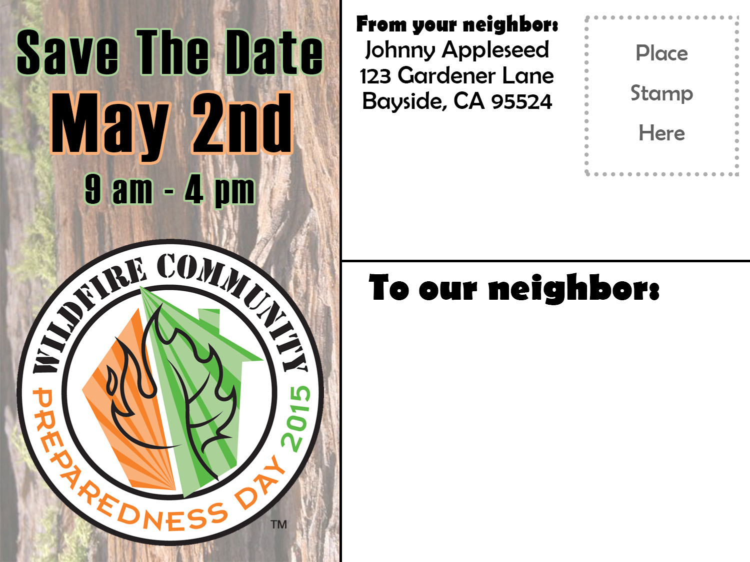
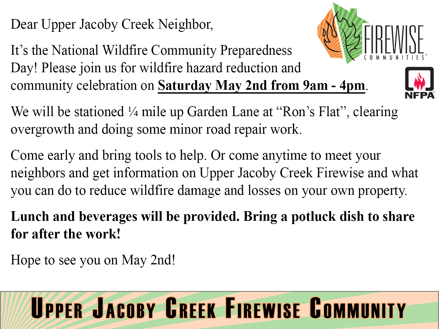
The Upper Jacoby Creek Firewise asked for help with designing and implementing a community survey and with planning and carrying out a neighborhood Firewise Day. Working under the direction of the team, I applied my knowledge of the Adobe Creative Suite to produce our promotional mailers and social media content for the project.
To develop the community survey, our team worked with Sarah Trapkus, the Upper Jacoby Creek Firewise leader, and Cybelle Immitt. Questions focused on water storage, fuel loading, visibility and access from roads, defensible space, and community involvement. The survey was conducted pursuant to HSU’s Institutional Research, Analytics, and Reporting standards. The survey was mailed to forty-seven parcels, identified in ArcMap using the County Assessor’s parcel data.
For up to date information on Firewise Communities in Humboldt County, visit the county-wide Firewise page.
Senior Practicum Project (2015)
© 2019 – The Official Website for Jerry Dinzes.