
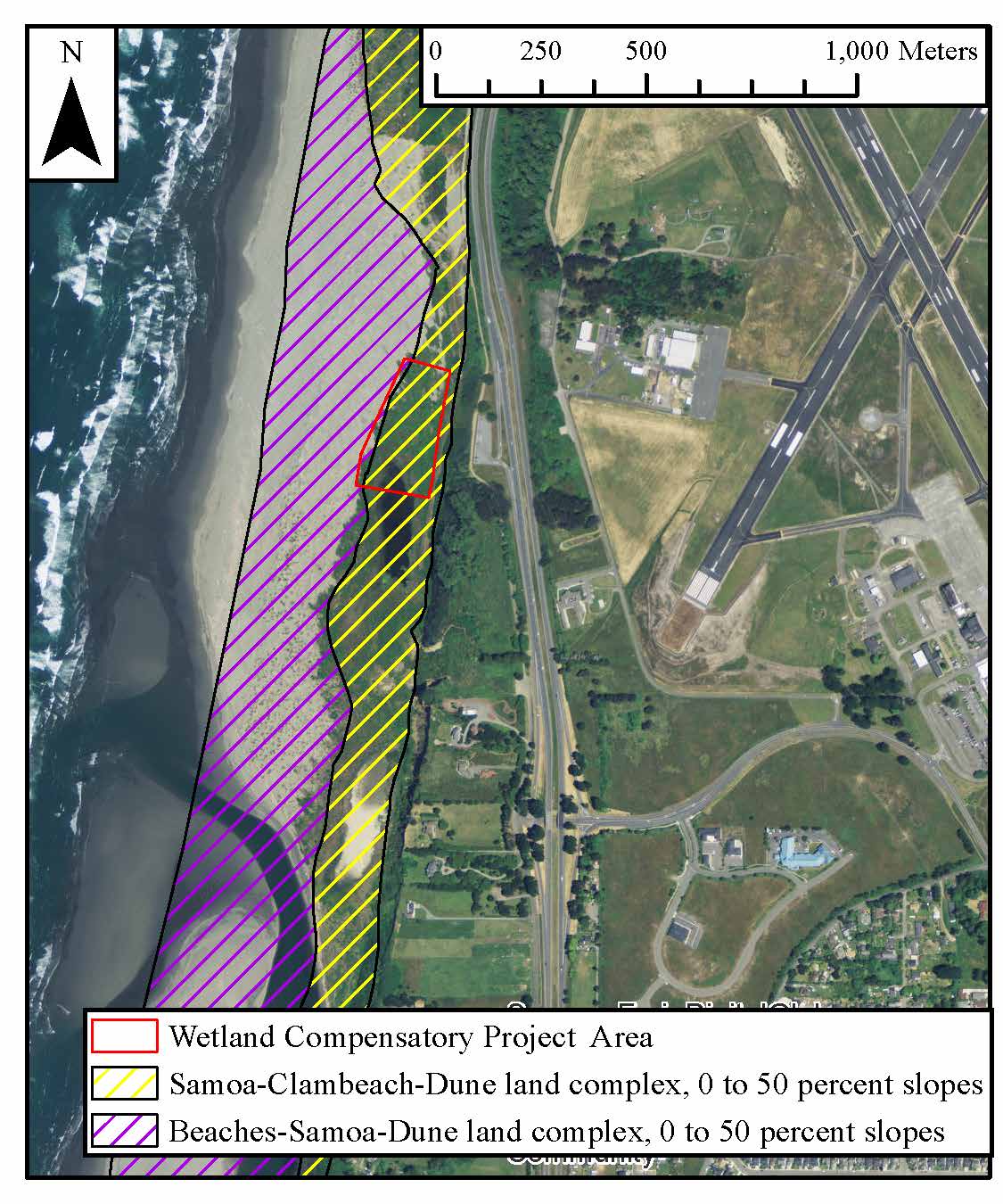
In 2014, our team conducted a wetland delineation to gauge the success of a compensatory wetland project. We selected this particular project with approval of the professor, and worked independently in conducting the delineation/assessment.
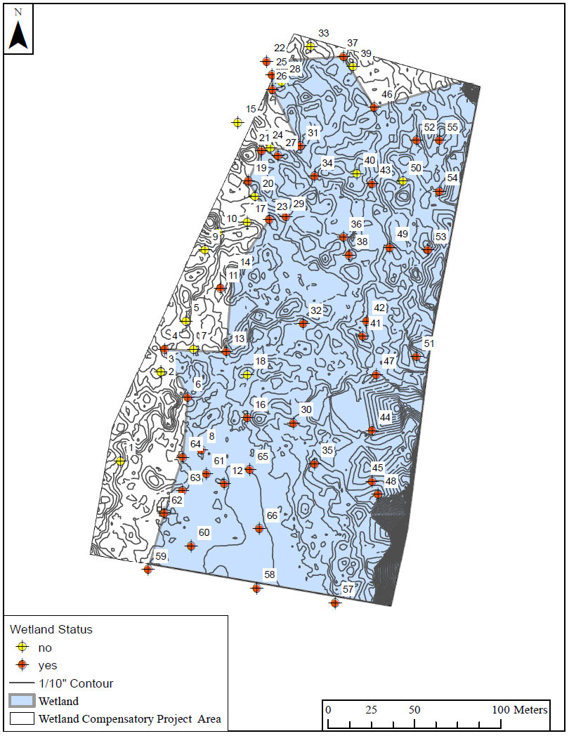
To delineate and analyze the compensatory wetland site, our project team used the ACE Regional Supplement to the Corps of Engineers Wetland Delineation Manual: Western Mountains, Valleys, and Coast Region (Version 2.0). Approximately 50 soil pits were examined for hydrological indicators, and in 1/3 of the pits, hydric soil indicators. Six areas adjacent to the pits were examined for hydrophytic vegetation using both the dominance and prevalence test. The spatial coordinates of each indicator were recorded using hand held GPS devices. In addition to conducting the field work with the team, I was in charge of data management and mapping.
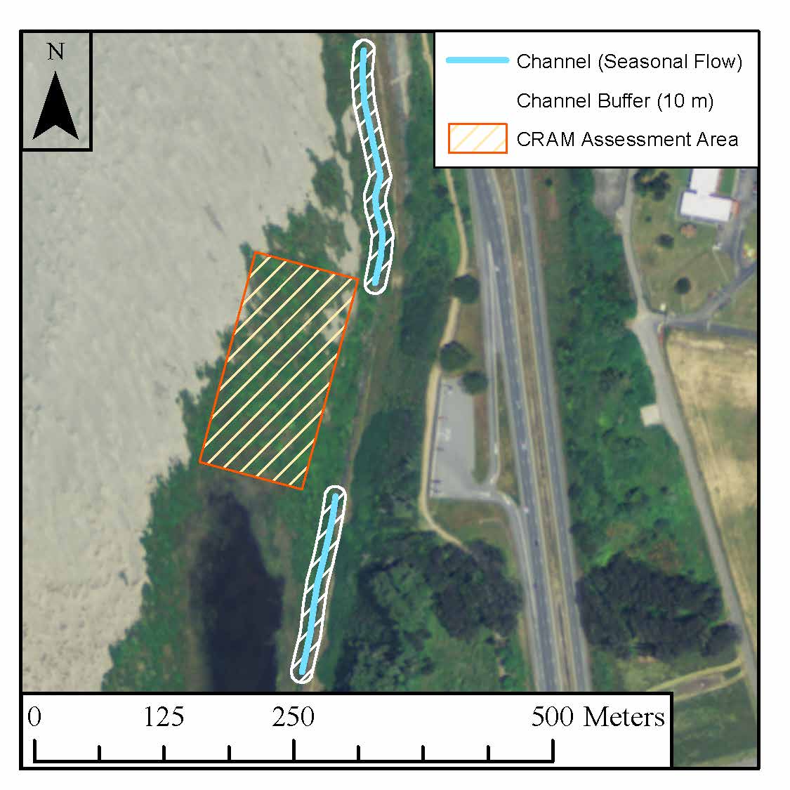
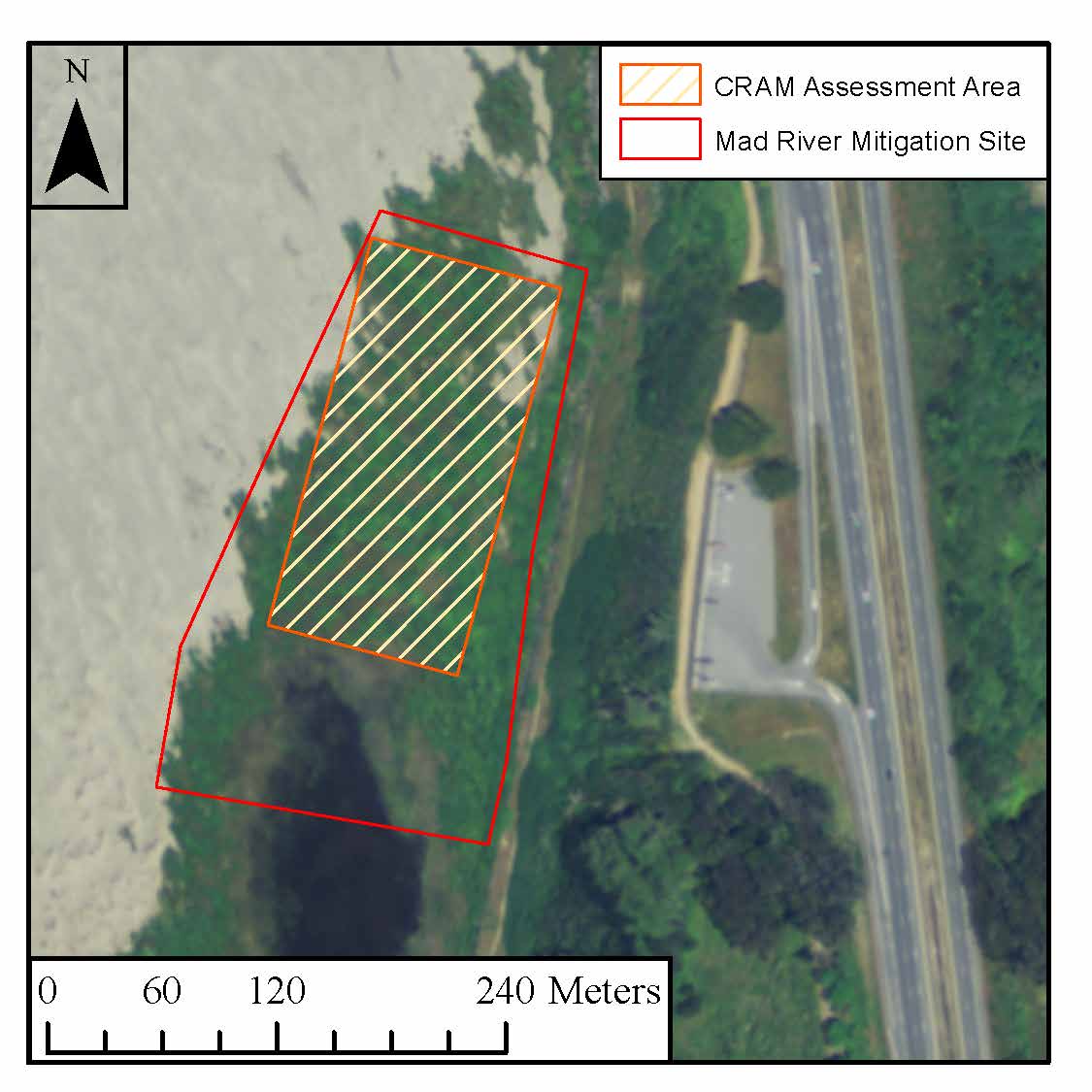
Using the California Rapid Assessment Model (CRAM), I collected and analyzed data to assess the performance of the compensatory wetland. An Assessment Area (AA) was used to assess wetland quality. ArcGIS was used in taking measurements and examining aerial photos.
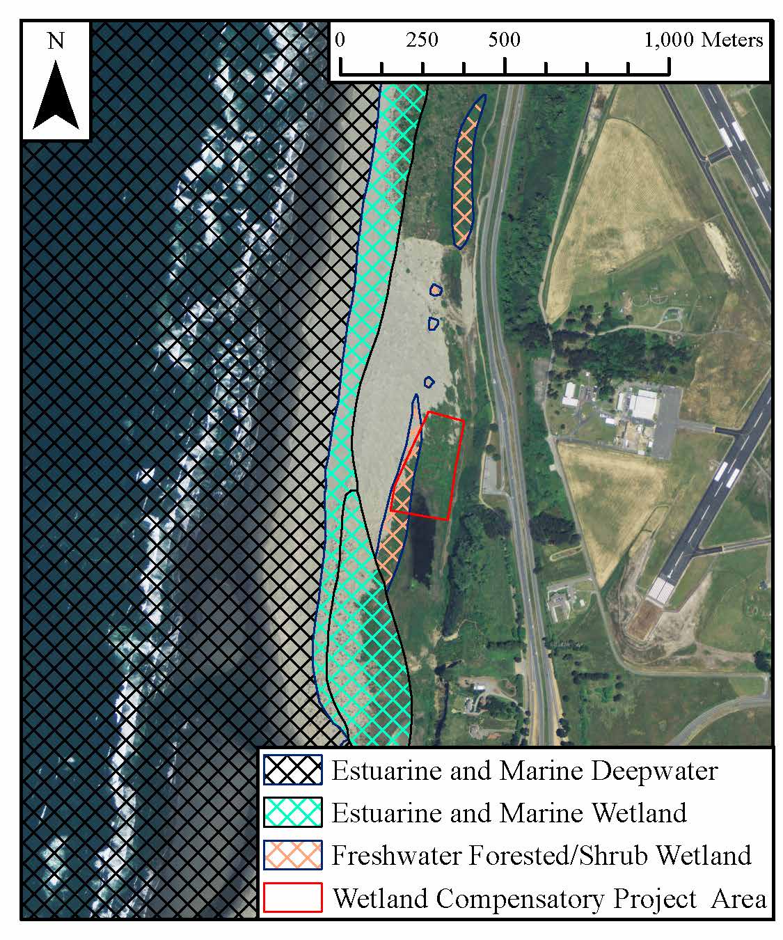
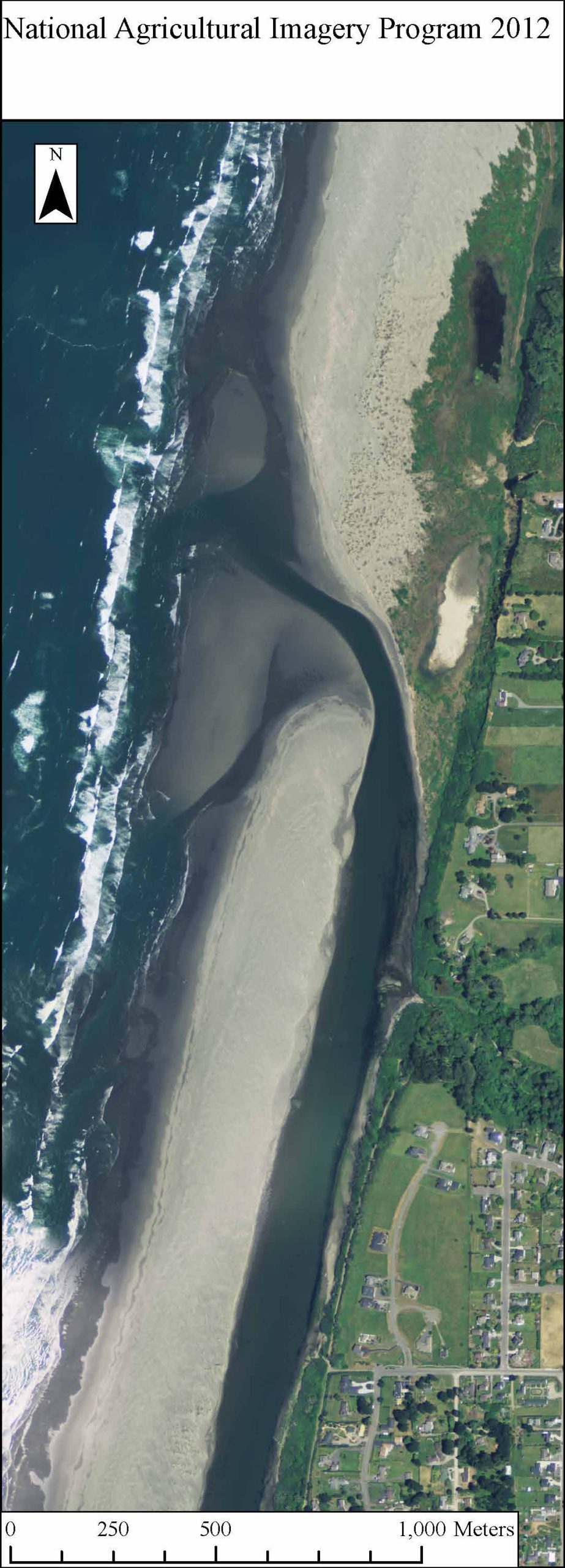
The compensatory wetland, in the upper left corner, is at risk of being wiped out by the migration of the river mouth. Time will tell whether proper compensation was offered. So it goes.
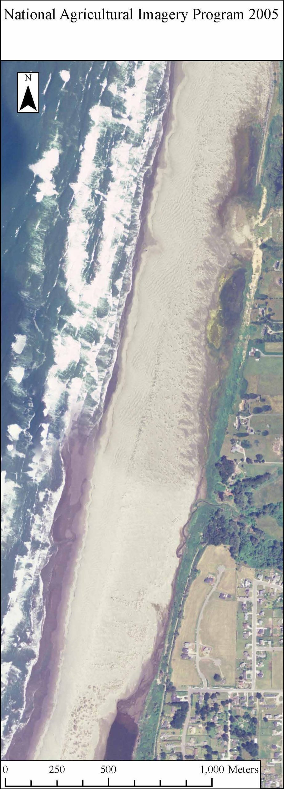
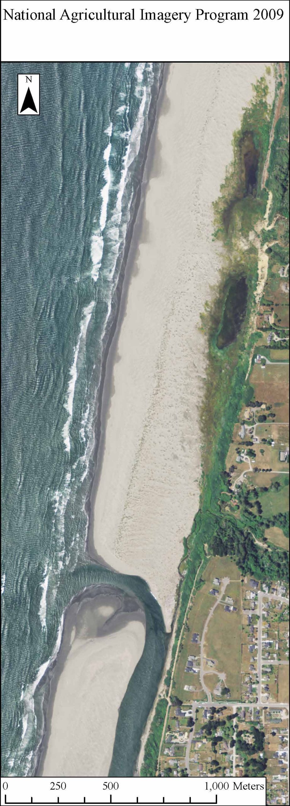
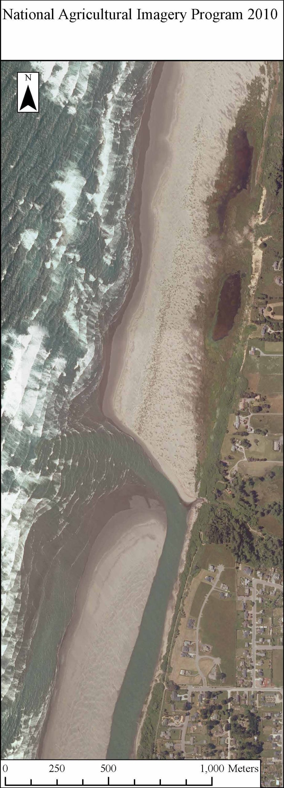
Maps by Jerry Dinzes
© 2019 – The Official Website for Jerry Dinzes.